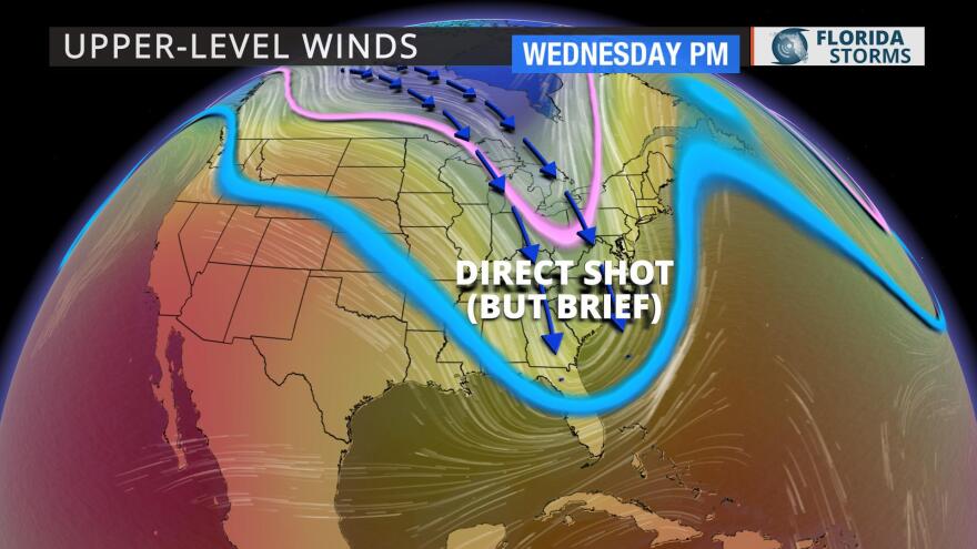
Temperatures will tumble this week in Florida. For the first time in nearly five months, a cold front will make it all the way through the Keys and Miami by Tuesday. This will not only mark the end to the state’s rainy season, it will send many to their coat closets to find a jacket or hoodie.
Read more: Here is South Florida's weather forecast for the next 7 days
The summer was warm and extremely wet in most of Florida. This has been followed by a warmer-than-normal first half of autumn as well. The game-changer of a front will move through the panhandle Monday, then across the peninsula Tuesday. Behind the front, the coldest air of the season is set to plunge south from Canada as the upper-level steering winds dive into the northern Gulf of Mexico.

The core of the cold air will arrive Wednesday and Thursday, when temperatures are expected to be nearly 20 degrees cooler than they were over the weekend. Morning lows are expected to drop into the 40s across the northern half of the state, and dip to the 50s in South Florida by Thursday morning. Afternoon highs will run below normal as well, possibly not even hitting 70 in northern areas, and falling short of 80 degrees further south.
The jacket weather will be short-lived, though, as temperatures are expected to return to normal by Friday. Late October normal temperatures are between 75 and 85 during the day, and generally in the 60s at night.


