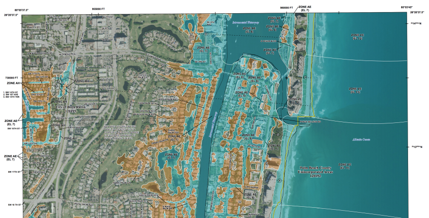
South Florida is getting new flood risk maps that are redrawing the lines for what property is in high-risk areas.
The maps, set by the Federal Emergency Management Agency, are used for city and county planning, determining which areas need flood insurance, and generally managing areas susceptible to flooding.
FEMA officials say the new maps are needed. Some of the data used to draw the ones currently in use across South Florida are 40 years old.
“It was time to re-do the coastal study,” said Mark Vieira, senior engineer and project manager for FEMA’s coastal studies. “A lot of technology has changed in 40 years, we’re using some different models and we’ve got better ground elevations than we’ve ever had.”
Alongside changes in how well FEMA is able to collect the data, they’ve also got 40 more years of data that help them test how well their models have worked, and adjust the new maps accordingly.
Some properties will move from being in areas at high risk for flooding, while others that were previously considered at low risk have become areas of higher risk.
- Information about the new proposed maps, and how to locate where a property is on those new maps, is here.
- The flyer FEMA distributed with a walk-through of how to toggle the current and proposed maps is here.
The new maps are not yet in effect. Vieira said finalization is still about 18 months to two years out. That allows time for the communities to tell residents about the proposed maps, for people and municipalities to appeal how areas were designated, and for FEMA to go through other procedural steps.
For those who live in areas whose flood risk is going up, that also buys time to get flood insurance before premiums skyrocket. People buying flood insurance early, before the maps are finalized, are grandfathered in with a lower premium rate.
FEMA has been holding open houses throughout South Florida to answer residents’ questions about the new maps, walk them through how to get federal flood insurance, and connect them to the local officials who can answer community-specific questions.
Turnout at Monroe County events last week was high — FEMA officials say they had some 500 attendees at an open house in Key West, compared to about 65 people at their first open house in Palm Beach County on Tuesday.
At the second of two Palm Beach County meetings, Paola West from the Village of North Palm Beach said they’d only had one resident stop by the village’s table to talk about the flood map — even as some 1,300 to 1,400 properties will be affected by the redrawn maps.
FEMA on Friday will hold two Broward open house sessions, in Pompano Beach and Hollywood.
Those who weren’t able to attend an open house can turn to their local municipalities. Local governments have floodplain managers, planners or other city officials, like West in North Palm Beach, who can help residents navigate the new proposed flood maps and figure out what other steps they might need to take — such as appealing a designation if they think they’re labeled incorrectly, or getting flood insurance if their risk is going up.


